An advanced solution for geospatial data acquisition, the DJI Matrice 300 RTK system, combined with the DJI Zenmuse L1 sensor, combines LiDAR technology with high-precision RTK positioning.
This equipment makes it possible to carry out topographical surveys, 3D modelling and technical inspections with great speed, reliability and detail.
Capable of operating in complex and difficult-to-access environments, it ensures efficient data collection even in demanding conditions, significantly reducing execution time compared to traditional methods. The integration of hardware and software provides accurate and consistent results, essential for engineering, planning and territorial analysis projects.
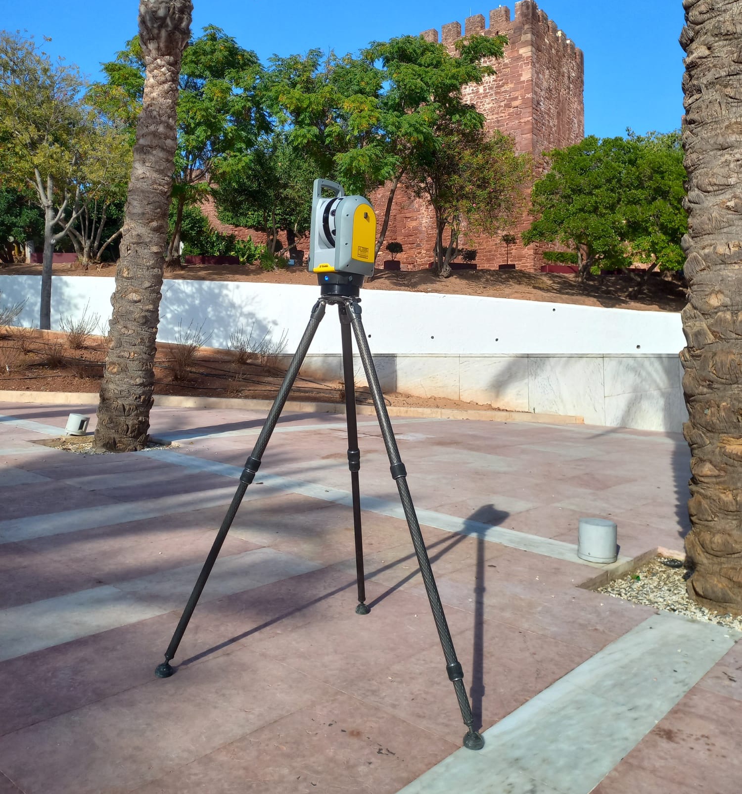
TRIMBLE X7 laser scanner
High-precision 3D laser scanning equipment, the Trimble X7 enables fast and detailed capture of environments and structures. Ideal for architectural, engineering and refurbishment surveys, this system guarantees the collection of millions of points with high rigour, creating reliable, highly detailed three-dimensional models.
Its advanced automatic calibration and field recording technology ensures consistent results and reduces processing time. Compact and easy to use, the Trimble X7 adapts to different types of project, including indoor and outdoor spaces, offering an efficient solution for technical documentation and spatial analysis.
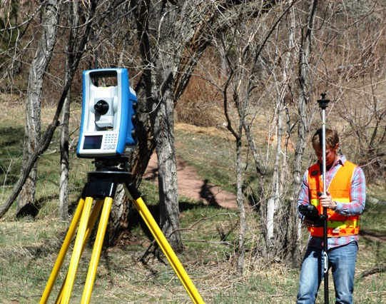
Spectra Precision FOCUS 35
A high-precision measuring device, the Spectra Precision FOCUS 35 total station is ideal for surveying and engineering work that requires rigour and reliability. It enables rapid data collection in the field, guaranteeing precise measurements in surveys, construction sites and geometric control.
Robust and adapted to different working conditions, it offers consistent performance even in demanding environments. Its ease of use and operational efficiency make it a practical solution for increasing productivity and ensuring quality results in any project.
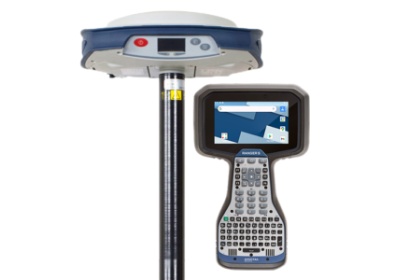
RANGER 5 with GPS SP 85
An integrated solution for high-precision surveying work, combining the Ranger 5 controller with the SP85 GNSS receiver. This system allows data to be collected in real time using RTK technology, guaranteeing high accuracy in surveys, markings and on-site support.
Robust and prepared for demanding conditions, it ensures reliable performance in the field, even in complex environments. Its mobility and ease of use make it ideal for increasing efficiency and productivity in engineering and surveying projects.
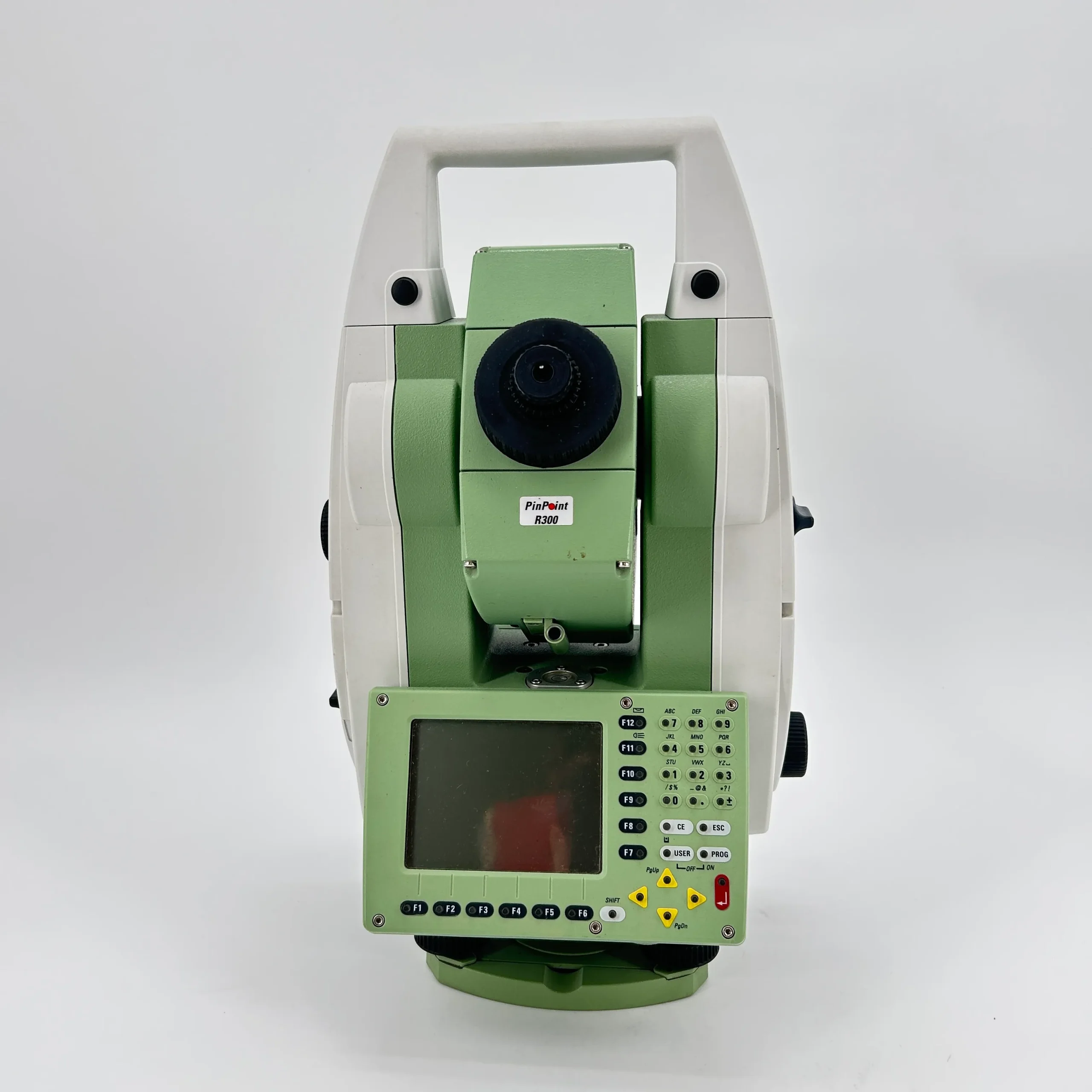
Leica TCRP 1203 total station
A high-precision measuring device, the Leica TCRP 1203 total station is ideal for surveying and engineering work that requires rigour and reliability. Developed by Leica Geosystems, it enables rapid data collection in the field, guaranteeing precise measurements in surveys, construction site implementation and geometric control.
Equipped with prismless measuring technology and automation capabilities, it allows for greater efficiency when carrying out work, even in hard-to-reach spots. Robust and adapted to different working conditions, it offers consistent performance in demanding environments and is a reliable solution for increasing productivity and ensuring quality results in any project.
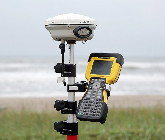
Trimble R8 GPS
High-precision positioning equipment, the Trimble R8 GNSS system is ideal for surveying and engineering work that requires rigour and reliability. Developed by Trimble Inc., it enables the rapid collection of data in the field, guaranteeing precise coordinates in topographic surveys, construction sites and georeferencing.
Based on advanced GNSS technology, it ensures consistent performance even in challenging environments, with good signal reception in urban areas or with obstacles. Robust and easy to use, it offers high operational efficiency, contributing to increased productivity and quality results in any project.
Contact us to find out how we can help with your project.